Full-stack GNSS R&D
Multi-constellation RTK receivers, UHF communication, IMU tilt compensation, visual stakeout, laser measurement, and antenna matching.
Factory-backed high-precision GNSS
Guangzhou Mars Terra Information Technology Co., Ltd. designs and manufactures GNSS base stations, rover receivers, visual laser RTK systems, compact helix antennas, and surveying software for global brands.
Who we are
Mars Terra combines receiver design, antenna integration, firmware, visual positioning, laser measurement, production, and after-sales engineering in one team. Our core R&D members have worked at leading GNSS and surveying equipment brands, bringing practical field knowledge into every product decision.
We support brand partners with confidential ODM and OEM programs, from product definition, PCB design, and solution integration discussion through hardware engineering, software integration, manufacturing, testing, and launch support.
Core strengths
Multi-constellation RTK receivers, UHF communication, IMU tilt compensation, visual stakeout, laser measurement, and antenna matching.
Factory production gives partners tighter control over quality, delivery rhythm, model customization, and private-label programs.
Core engineers from established positioning brands understand demanding RTK workflows, certification needs, and channel expectations.
Support for PCB board design, solution integration, logo, enclosure color, firmware settings, accessories, documentation, packaging, and regional frequency requirements.
Product portfolio
Mars Terra products are organized into base stations, rover receivers, antennas, single-base differential service software, and TerraX surveying software for field collection and stakeout.

Base Stations / Base Station Class
CORS, VRS, GBAS, timing and monitoring
Rugged base-station hardware for continuous correction data, network RTK services, timing, monitoring, and local field data hub deployments.

Rover Receivers / Mobile Stations
MR2 and MR1 visual laser RTK
Compact mobile-station receivers for field collection, visual stakeout, tilt survey, and non-contact laser measurement in hard-to-reach or unsafe locations.
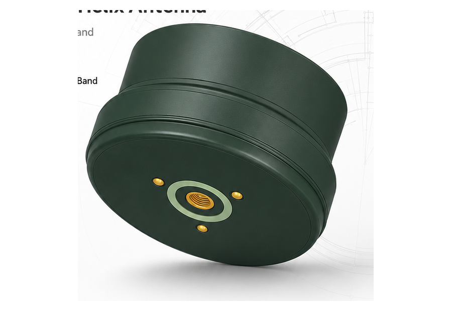
Antennas
HA701, HA-301A, and HA-901A helix antennas
Compact, lightweight helix antennas for UAVs, mini RTK devices, handheld controllers, tablets, and private-label portable positioning systems.
Single-Base Differential Service Software
Local RTK correction service
Software for building a simple correction service around one base station, helping teams distribute stable differential data to rovers in local projects.
TerraX Survey Software
Field survey and stakeout workflow
TerraX connects Mars Terra RTK hardware with practical surveying workflows for data collection, point stakeout, coordinate management, project files, and field deliverables.
ODM / OEM cooperation
Target market, channel price band, satellite support, enclosure, accessories, and brand positioning.
PCB board design, GNSS board architecture, antenna selection, IMU, laser, cameras, communication modules, firmware, and data formats.
Solution architecture discussion for GNSS receiver, antenna, correction service software, TerraX field workflow, and partner platform needs.
Factory assembly, functional testing, packaging, serial tracking, and delivery planning for repeat orders.
Documentation, field feedback, software settings, troubleshooting, and future model iteration.
Custom GNSS, communication, power, interface, and carrier-board design for partner products.
Joint discussion on receiver, antenna, IMU, laser, camera, radio, 4G, software, and field workflow integration.
Engineering samples, function checks, signal tests, enclosure fit, accessories, and field feedback loops.
Private-label appearance, firmware options, manuals, packaging, test reports, and mass-production handoff.
Quality focus
IP67 / IP68 product targets, shock and vibration considerations, long working temperature ranges, and rugged casing choices.
Multi-constellation, multi-frequency GNSS tracking, anti-interference antenna design, LNA filtering, and stable RTK initialization.
Visual stakeout, laser measurement, tilt compensation, smart control panels, and quick connectivity for faster field collection.
Start a conversation
Share your target market, required receiver type, antenna requirements, communication bands, branding needs, and expected order volume. Mars Terra can respond with product options and cooperation paths.